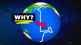
The Coastline Paradox Explained
video description
What you are talking about is -function approximation, - that is when you find a line -say, a portion of coastline, and you want to build a function that represent that, for instance, a polynomial, which represents a curve that approximates to the coastline formation on each term you add. Thats sort of -resolution climbing- that tends to converge asymptotically to the form of the coastline.
The problem here, though, is that -you add new elements between two given points, - each time you increase resolution, so you -unfailingly add more distance with resolution. - So for instance, each time you duplicate the segments used to measure the coastline, you do approximate better to the shape of the coast, but increase distance. So the surface contained tends to converge to a number, but not the perimeter.
You may confuse this with a circumference, as a polygon of infinite sides, that has a finite and determinated length. Likewise, youd say this is the exact same case. But no, because the circle has a certain shape, and once you -zoom in-, or add resolution to approximate it, you dont find irregularities. In other words, -the length between two points do increases with resolution, but each time it does it predictably slower. -
In contrast, -coastline measurement finds irregularities each time you increase resolution. - And with -irregularities- we mean -new elements- -with their unique shape each: a peninsula, a beach in part of it, a group of rocks at the beach, a single rock, a hole in the rock, a different hole inside that hole, grains of sand inside it, each grain different from each other, an so on. Perhaps in molecular or atomic environment we could finally find some sort of regularities, that could finally give us a function similar to the circumference case, and that could end in a finite size.
But the case here is that -measuring things in tiny segments (say, millimiters) gives us counter intuitive notion of length. - For instance, adding the shape of 1-metre-sized rocks to measure the length of a beach between two mountains that are 1 kilometre (straight line) between increases dramatically what you _perceive_ is the size of that curved line beach. How much do you think it measures? Well, about some amount above 1km, say 1. 3km. But if you start to add the irregularities (say, rocks and sand formations) that beach can measure 3km, which seems nonsense.
So in my opinion, the solution would be to use -representative segments- to measure coastline with some considerations:
1) Small enough to take irregular coasts into account.
2) Big enough not to fall into the -infinite problem- talked above.
3) The unit used must be feasible -the smaller, the more difficult, of course.
4) The most important: Everyone should use the same segments.
So Id say a 100 or 500-metre segment would be the fairer segment to use to measure coastlines around the world. Dunno if feasible, but certainly fairer.
Date: 2023-12-14
Related videos


Comments and reviews: 24
-jayestes_vids
There-s a pretty reasonable solution to this -conundrum-. You can go down to the infinite molecule by molecule measurement if you want, but in all of those cases, if the overall landmass (square miles) doesn-t change much- you have effectively answered the question. At some point, your infinitesimal darting around doesn-t really add any significant land area, so it-s useless. For each coastline computed, if we calculate the total land area, and as we incrementally decrease our point spacing at the coast, at some point the land area increase becomes less than (say for instance) 1%. At this point you are -effectively done-, and higher resolution is not worth the effort. Amazing to me that no one has decided some coastline perimeter to total land mass area ratio is reasonable, defines a standard by which all coastlines are measured and defined a standard.
reply
-blindsniper35
This is not a paradox, It's a trade-off between resources and what's possible to what resolution of detail you need for the problem you're solving.
The more detail you add the closer you get to the true number which is a finite number. The distance keeps increasing but the amount it increases decreases every time you add more points. Until you run into the fact that there are no more meaningful places to put points. Then whatever that answer is is your true distance. Assuming the best definition of a shoreline you could come up with is down to the atom. The amount of atoms that make up the shoreline and the distance between them would be the true distance.
TLDR: The more points you add the closer you get to the real value. It just doesn't make sense to try to measure a shoreline down to the smallest possible point.
reply
reallifelore
A solution would be to create multiple standards for measurement. Some standards may be based on the meter and converted into useful information such as miles or kilometers. And would be measured at the average tidal height, leaving room for high tide and low tide. Another standard could be effective coastal length. Which could be measured by kilometers. This would remove the confusion in areas like Norway where the effective cost to length would give you an idea of the size of the country while the precise length. Would give you a more precise definition of the expense of the coast
reply
-logannabozny3031
It doesn't approach infinity, it approaches the actual length of the coastline.
As the segments get smaller, the length approaches 0. You can add an infinite amount of segments of length 0, that doesn't make it infinity kms long, it makes it infinity UNITS long. Yes, the folds and fractals will increase the length measured, but the length measured will never be infinity, it will be the finite actual coastal length.
Even if measured down to the atomic level, 1in is still 1in even if it is measured in 25. 4 BILLION hydrogen atoms.
reply
-danifernandez8320
Genuine question, so what's the value of constantly measuring coastlines if cartographers are able to create mostly accurate maps and globes? Is it for them to be constantly updated, or is it some territorial country border thing that will help prevent disputes between two nations?
reply
Genuine question, so what's the value of constantly measuring coastlines if cartographers are able to create mostly accurate maps and globes? Is it for them to be constantly updated, or is it some territorial country border thing that will help prevent disputes between two nations?
reply
-ianjackson4721
Not to mention the question: Do rivers count towards coastline if they border a body of water that can reach the oceans? Like in Canada, there-s a ton of rivers that connect to the arctic or Great Lakes / St Lawrence, do those count towards the total coastline?
reply
Not to mention the question: Do rivers count towards coastline if they border a body of water that can reach the oceans? Like in Canada, there-s a ton of rivers that connect to the arctic or Great Lakes / St Lawrence, do those count towards the total coastline?
reply
-C. Sharpe
Could you not just travel along the coastline and measure how far you travel? Like counting steps or miles traveled or something. That would be a good balance of scale and accuracy, because you're measuring on a human scale so it's easy to understand.
reply
Could you not just travel along the coastline and measure how far you travel? Like counting steps or miles traveled or something. That would be a good balance of scale and accuracy, because you're measuring on a human scale so it's easy to understand.
reply
-trublgrl
You cannot measure a coastline in molecular lengths. Molecules are, by definition three dimensional, they change relative length based on their orientation in 3d space. A coastline is a measure of length, a two-dimensional construct.
reply
You cannot measure a coastline in molecular lengths. Molecules are, by definition three dimensional, they change relative length based on their orientation in 3d space. A coastline is a measure of length, a two-dimensional construct.
reply
reallifelore
I don't know how it works but you can just put a guy and measure the coastline of a country by a kilometer it might just take you so long but you don't need to zoom to atoms this is just what I thought or think so don't be angry
reply
I don't know how it works but you can just put a guy and measure the coastline of a country by a kilometer it might just take you so long but you don't need to zoom to atoms this is just what I thought or think so don't be angry
reply
-samninjago8216
what is you just drive around the coast of the uk at lets say 30mph and it takes you 36 hour to do it then you just do 30-36 witch if those number
wernt made up thee coast would be 1080 miles
reply
what is you just drive around the coast of the uk at lets say 30mph and it takes you 36 hour to do it then you just do 30-36 witch if those number
wernt made up thee coast would be 1080 miles
reply
-djdeemz7651
If you include decimal points you cant count from 0 to 1 because there will be an infinite amount of numbers between 0 and 1
0. 1 0. 001 0. 0001 0. 00001 0. 000001 etc into infinity
reply
If you include decimal points you cant count from 0 to 1 because there will be an infinite amount of numbers between 0 and 1
0. 1 0. 001 0. 0001 0. 00001 0. 000001 etc into infinity
reply
-iLeetjeeh
This just seems needlessly complicated. Just pick 1m or 100m instead of 50km. You will get a very accurate estimate. I don't understand why people need to make it so complicated.
reply
This just seems needlessly complicated. Just pick 1m or 100m instead of 50km. You will get a very accurate estimate. I don't understand why people need to make it so complicated.
reply
reallifelore
Sounds like something that can be solved by using a concept similar to how integrals are described and an appropriate computing machine fed with the shape of the coastline -
reply
Sounds like something that can be solved by using a concept similar to how integrals are described and an appropriate computing machine fed with the shape of the coastline -
reply
-jasonderby7635
A coastline is simply a line of demarcation. This is a useless paradox, doesn-t that logic apply to the measurement of everything once you take it to a molecular level?
reply
A coastline is simply a line of demarcation. This is a useless paradox, doesn-t that logic apply to the measurement of everything once you take it to a molecular level?
reply
-yetaloz814
Couldnt't one get a device that measures how much you walked, and then walk the entire coastline? I know it's crazy, but it could work to get the closest estimate lol.
reply
Couldnt't one get a device that measures how much you walked, and then walk the entire coastline? I know it's crazy, but it could work to get the closest estimate lol.
reply
-TheGrinningViking
If only there was some sort of computing machine that could take a wriggly irregular line and measure it's entire length rather than humans doing it in cubes.
reply
If only there was some sort of computing machine that could take a wriggly irregular line and measure it's entire length rather than humans doing it in cubes.
reply
-derlowenkonig7971
Didn't not find a vomment on what the obvious appliance of this effect is. Well, i will now go to the bathroom and check some numbers.
reply
Didn't not find a vomment on what the obvious appliance of this effect is. Well, i will now go to the bathroom and check some numbers.
reply
-clearestseb
This doesn't seem like much of a paradox to me. If you use a different approximation you'll get a different answer? That seems quite obvious
reply
This doesn't seem like much of a paradox to me. If you use a different approximation you'll get a different answer? That seems quite obvious
reply
reallifelore
Get a really long string and pull it across the coastline through every little gap then measure the string after you pull it back straight
reply
Get a really long string and pull it across the coastline through every little gap then measure the string after you pull it back straight
reply
-sehrzeb9485
a simple concept that this video obfuscates with clumsy convoluted terminology and condescending hyper-cheery voiceover. annoying as.
reply
a simple concept that this video obfuscates with clumsy convoluted terminology and condescending hyper-cheery voiceover. annoying as.
reply
-OffTheRailsUK
3: 02
Ah yes, 2018 back when we had FGW operating in Dawlish (Location in clip) and slam door Mk3 units.
Oh how I miss those
reply
3: 02
Ah yes, 2018 back when we had FGW operating in Dawlish (Location in clip) and slam door Mk3 units.
Oh how I miss those
reply
-histographer1776
All you have to do to find the length of a coastline is get a really long tape measurer, and then walk along the ocean
reply
All you have to do to find the length of a coastline is get a really long tape measurer, and then walk along the ocean
reply
-pusheenthecat9264
On top of all those problems, there is the tide. The coastline shrinks and grows throughout the day because of it.
reply
On top of all those problems, there is the tide. The coastline shrinks and grows throughout the day because of it.
reply
-markmcculfor6113
Wow, this video is literally a perfect copy of Veritasium's video, same quotes, same order of explanation
reply
Wow, this video is literally a perfect copy of Veritasium's video, same quotes, same order of explanation
reply
Add a review, comment
Other channel videos